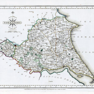
c1885 - An original colour antique map titled: " YORK "
Taken from "The Royal Atlas of England & Wales reduced from the Ordnance Survey - A complete series of topographical maps, physical and statistical Charts, Town Plans and Index of 35,000 Names" edited by J G Bartholmew & published by George Newnes Limited, Southampton Street, Strand, WC. London
Overall size approximately 36cm x 23.5cm (14.1 x 9.2in) with central fold as issued.
£22.00