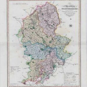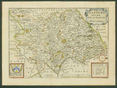
1671- Original antique map titled: 'A Mapp of STAFFORDSHIRE with its Hundreds'
A good example of this map.
Overall size of print is 28cm x 21cm with large margins, perfect for mounting.
CONDITION: Excellent condition with good margins, perfect for mounting and framing. Being nearly 350 years old, this map has some very light age toning on the front.
Richard Blome (1635-1705) was an engraver, cartographer, and publisher in the Kingdom of England.
Richard Blome's cartography flourished in the second half of the seventeenth century. He produced a great number of maps, but none were original, and he was often accuséd of plagiarism although usually made no attempt to hide his sources. His maps were attractive and quaintly designed, and they still retain their nostalgic look.
Blome's series of county maps were combined in the Britannia, based on the latest editions of mapmaker, John Speed, and was published in 1673 but was not a success. It was followed in 1681 by an issue of smaller maps entitled Speed's Maps Epitomiz'd. Most of his work was engraved by Wenceslaus Hollar, Richard Palmer, and Francis Lamb, and embellished with dedications to county dignitaries which were added or omitted in later editions.
£90.00