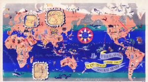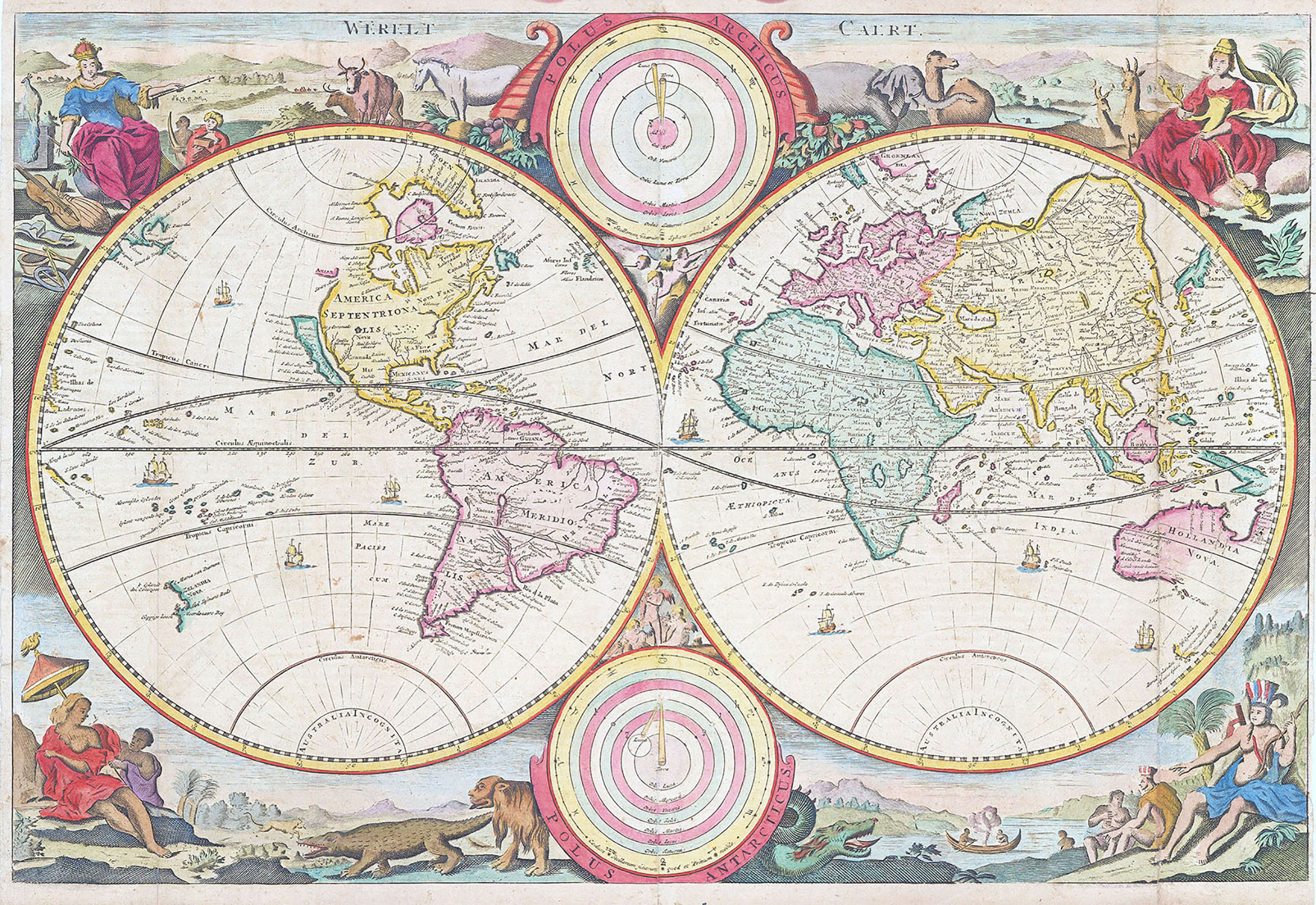
"WERELT CAERT" c1680
Hand coloured world map from a Dutch bible by Daniel Stoopendaal. The map is based on Nicolas Visscher's map of 1663. Showing a double-hemisphere world map with two solar charts, one centered around the sun, the other earth-centred. Surrounded with allegorical representations of the continents. California as an island, with a flat northern coastline, diagrams of the Copernican & Ptolemaic solar systems in between the hemispheres & illustrations of various animals and people in regional dress.
This is a good collectable example. It has two historical repairs to tears on the left and right sides & the margins are close but clear.
Size approx 46cm x 32cm.
£1,000.00