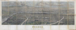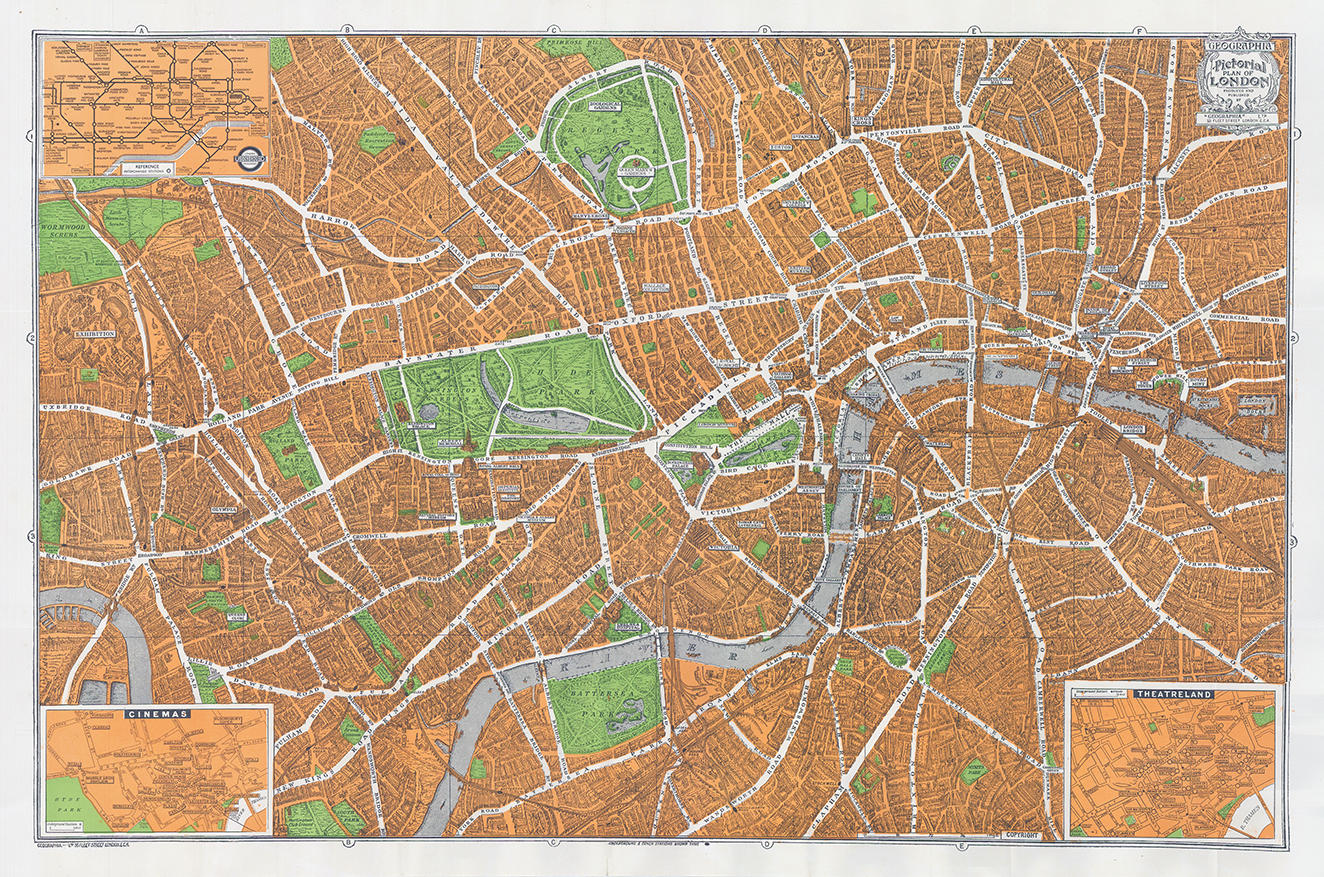
1936 "HOMELAND PICTORIAL PLAN OF LONDON”
This wonderful original vintage folding city plan of London was published in 1936 by Geographia, just a few years before the Blitz would forever change the landscape of England’s capital. The urban density is reflected in the illustrated profile view of each block throughout the city’s central section. Further vignettes and accompanying labels identify many of the most prominent locations of interest like the Tower, St. Paul’s, Westminster Abbey, and the British Museum.
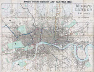
Bright green highlights public outdoor areas like parks, squares, and cemeteries – all popular locations for recreation and amusement. Two inset maps showcase more of London’s popular cultural attractions, highlighting details of the Theatre and Cinema districts.
Overall size approximately 50cm x 75cm once fully opened.
Condition is excellent with folds, as originally issued.
£85.00