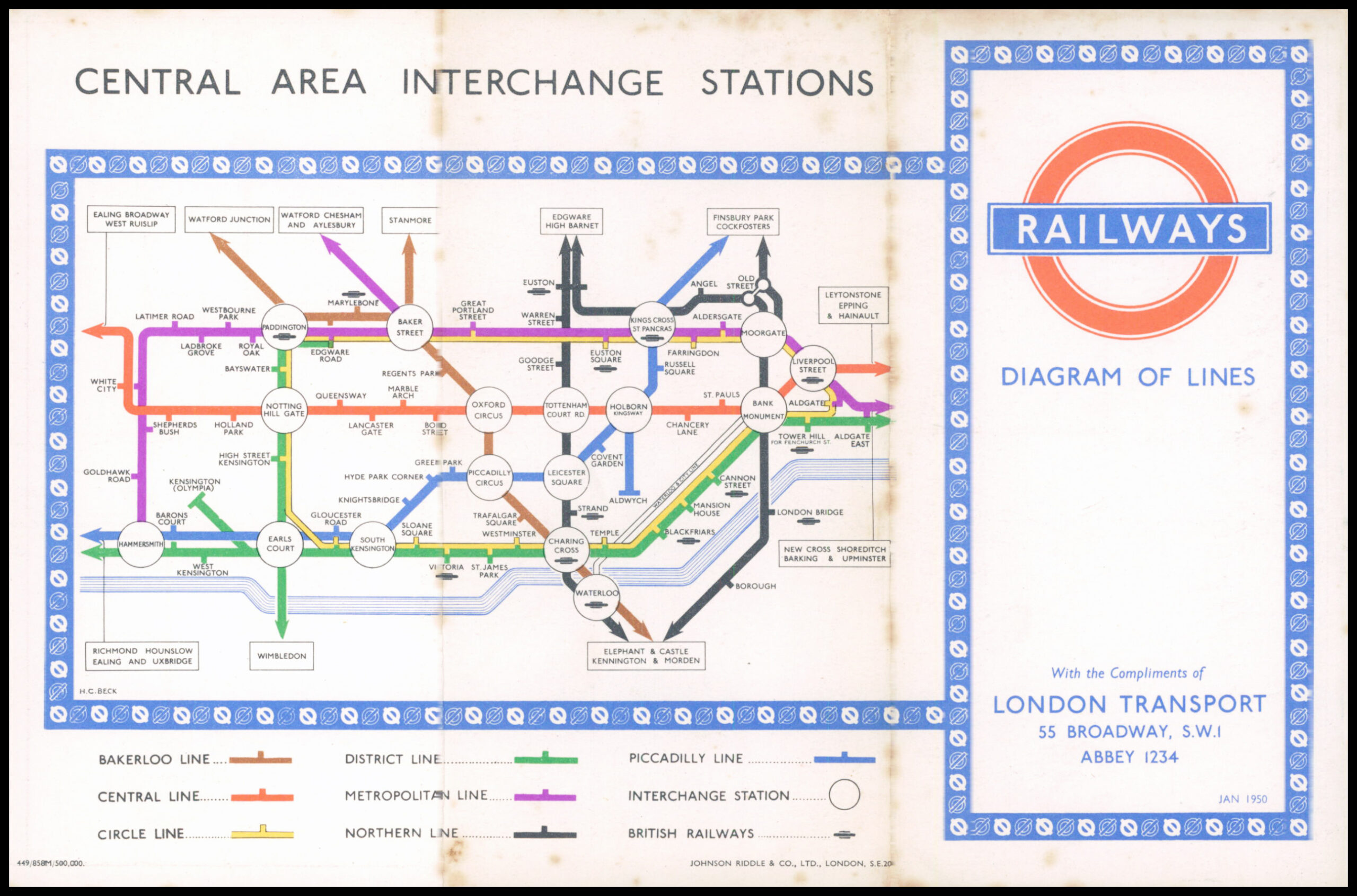
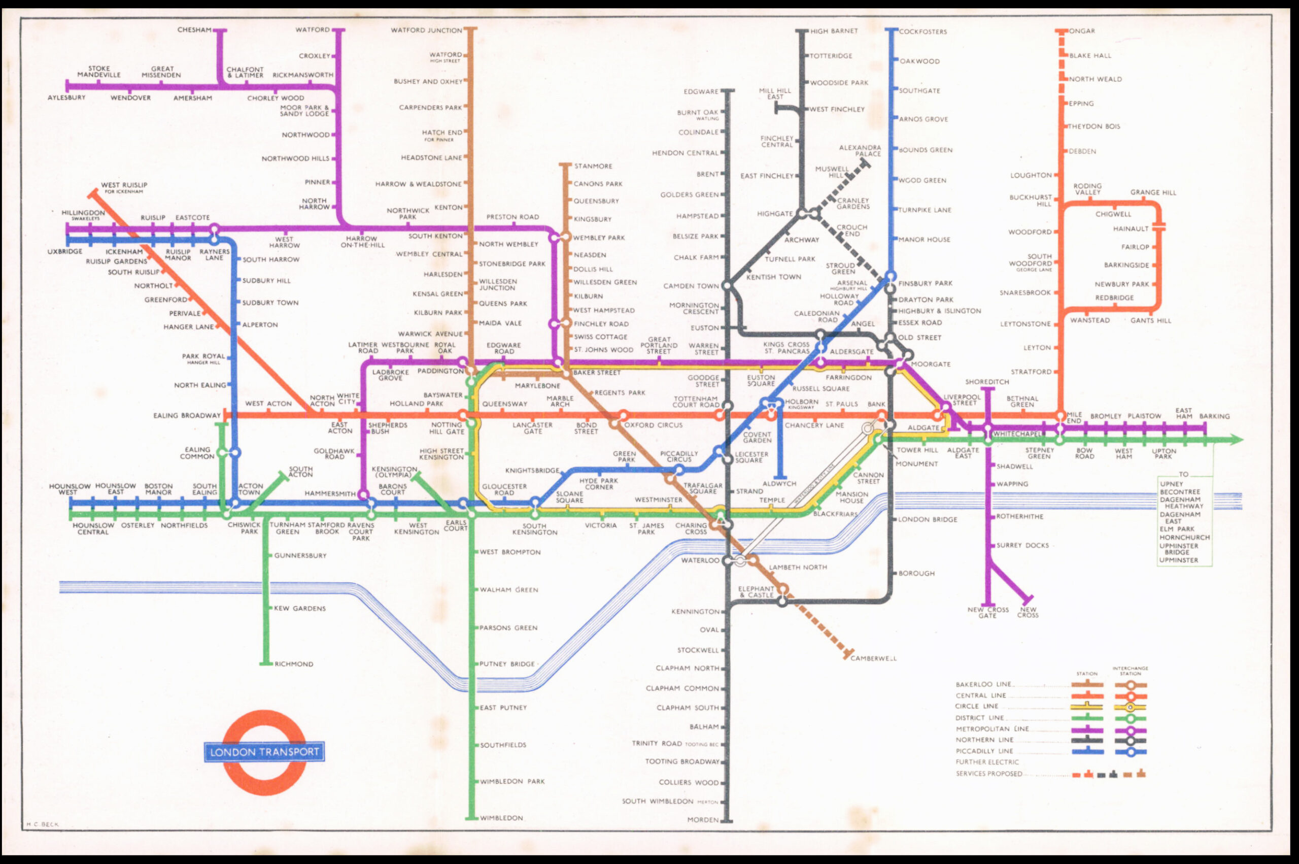
1950 This is an Original Vintage London Underground map produced by London Transport and with the iconic design by HARRY BECK.
The map shows the Metropolitan line extending as far as Aylesbury (the line beyond Amersham was transferred to British Rail in 1961); the District Line spur to South Acton (closed 1959); the Northern Line City section from Old Street to Finsbury Park via Essex Road (closed 1975); the proposed Northern Line extension to Stroud Green, Crouch End, Muswell Hill and Alexandra Palace (not built); the proposed Bakerloo line extension to Camberwell (not built); the proposed Central Line extension to Ongar (built with a discontinuity at Epping - from which point onwards the line was closed in 1994); The Piccadilly Line spur to Aldwych (closed 1994); The line between Baker Street and Stanmore is shown as a branch of the Bakerloo line, as it was until it became part of the Jubilee line upon its opening in 1979.
The map is in good condition with 2 folds to make it a pocket map. Overall size approx 22.8cm x 15cm. (LTM5/6)
£95.00