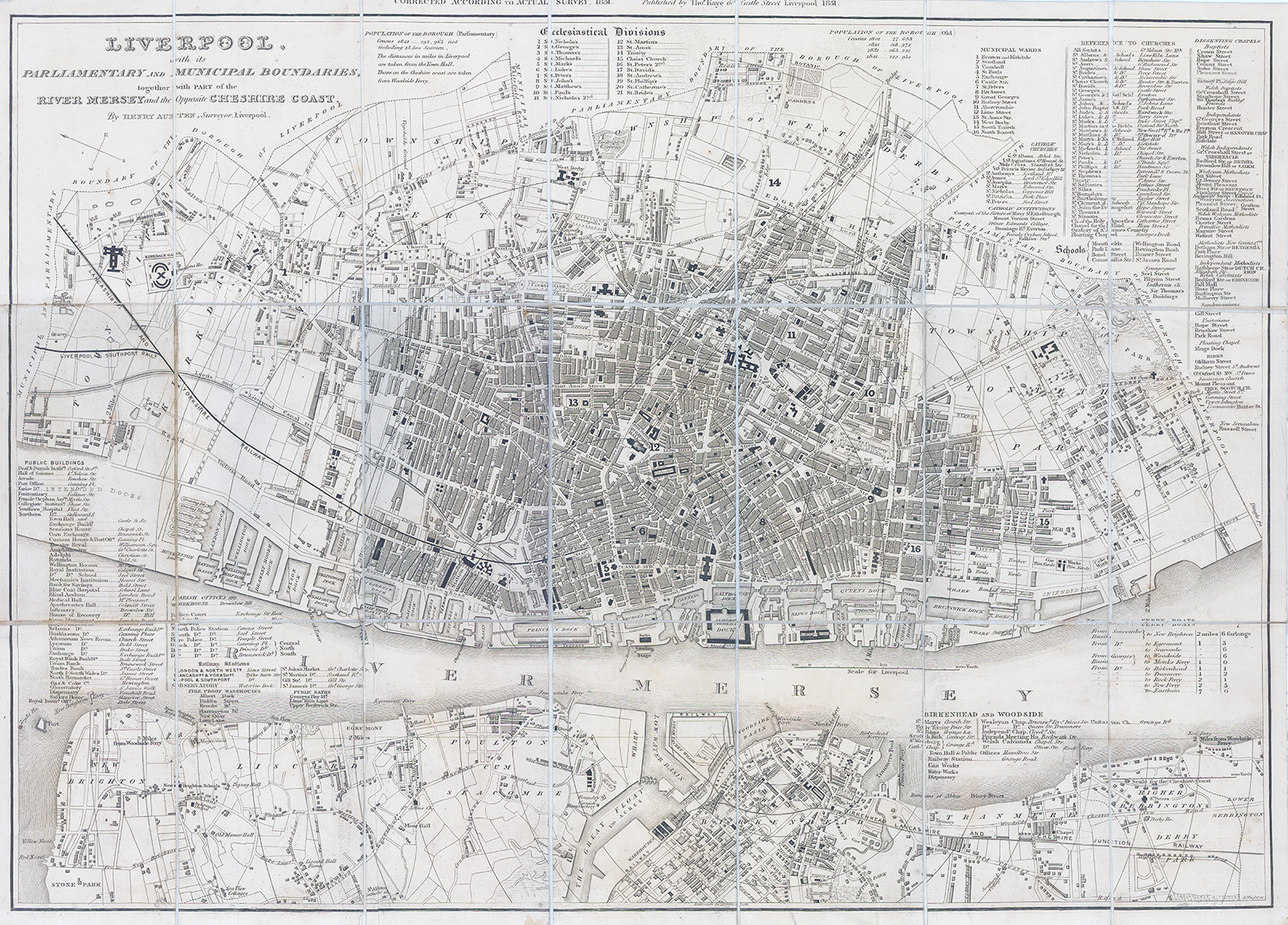
1851 "LIVERPOOL with its PARLIAMENTARY AND MUNICIPAL BOUNDARIES, together with PART of the RIVER MERSEY and the Opposite CHESHIRE COAST by Henry Austin, Surveyor, Liverpool".
A fine and scarce original antique folding map, dissected into 21 sections and laid to linen and folded into cloth titled binding "MAP OF LIVERPOOL AND ITS ENVIRONS". A highly detailed map of the City of Liverpool with various tables 'ECCLESIASTICAL DIVISIONS" - "MUNICIPAL WARDS" - "REFERENCE TO CHURCHES" - "FERRY BOATS" - "BIRKENHEAD AND WOODSIDE" etc.
Overall size when opened up 54cm x 40cm. Condition is excellent.
£275.00