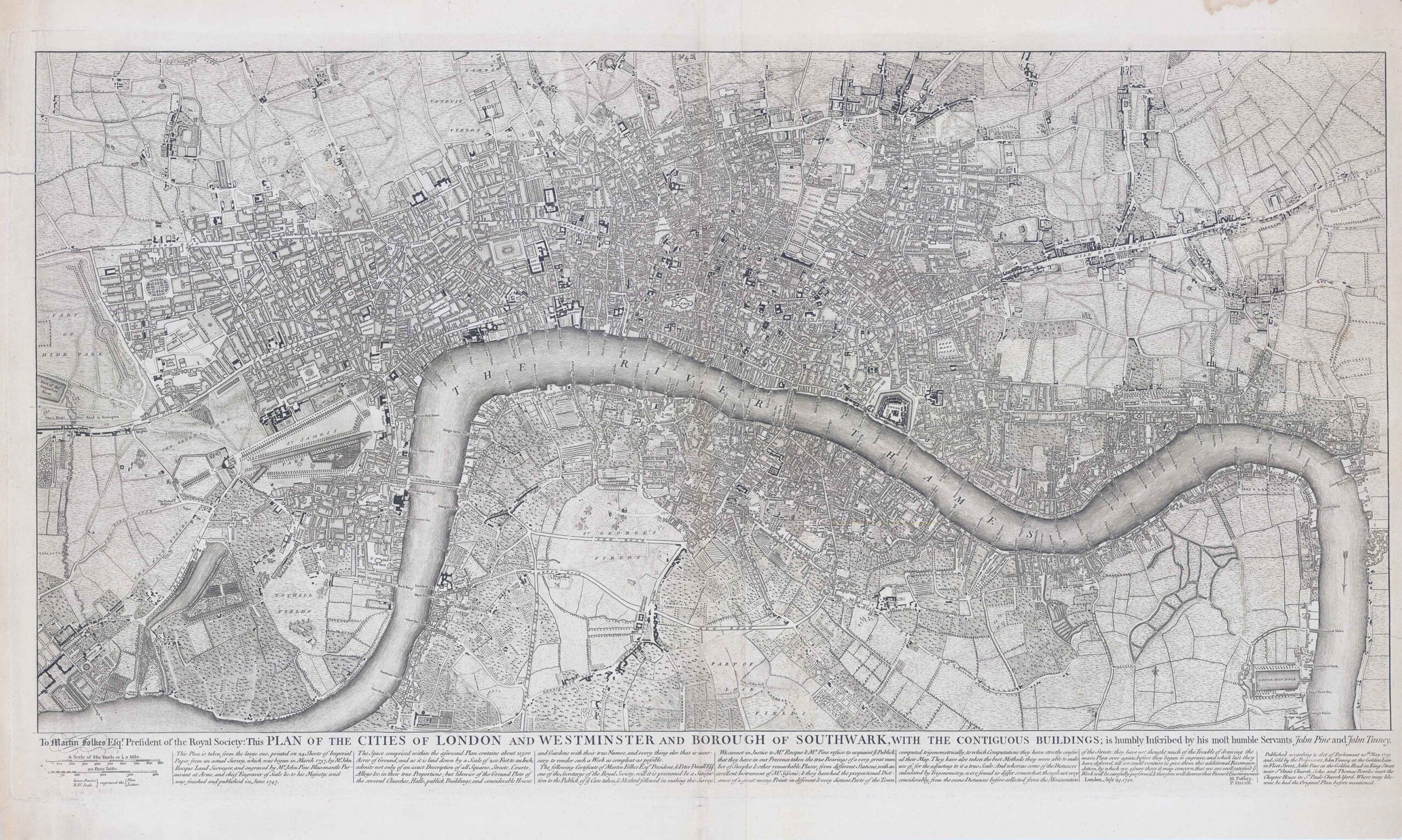
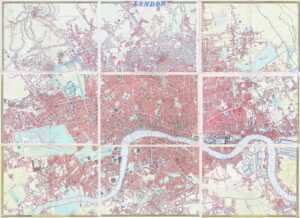
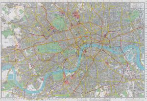
1763 "To Martin Folkes Esq(ui)r(e) President of the Royal Society: This Plan of the Cities of London with the Contiguous Buildings; is humbly inscribed his most Humble Servants John Pine and John Tinney".
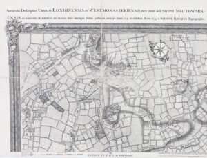
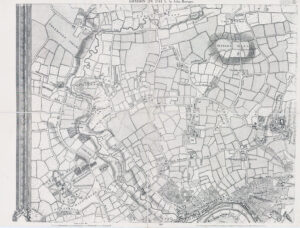
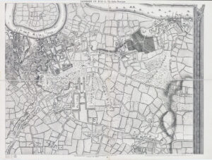
A fine & rare large panoramic plan of London by John Rocque. The text below the plan states that the map was taken from Rocque's great survey of the city, the surveying of which was begun in 1737 and took nine years for Rocque to complete. 'Published according to Act of Parliament, Sold by tghe Propriertors John Bowles in Cornhill, Carington Bowles in St. Pauls Church Yard, Robert Sayer in Fleet Street and Thomas Jefferys at the Corner of St. Margins Lane in the Strand, 20th May, 1763, London'. Howgego 100 (3)
Rocque was born in France in about 1704, one of four children of a Hugyenot family who subsequently fled first to Geneva, and then, probably in 1709, to England. He became a godfather in 1728, which suggests he was at least twenty-one years old by that time. In addition to his work as surveyor and mapmaker, Rocque was an engraver and map-seller. He was also involved in some way in gardening as a young man, living with his brother Bartholomew, who was a landscape gardener, and producing plans for parterres (gardens), perhaps recording pre-existing designs, but few details of this work are known. Rocque produced engraved plans of the gardens at Wrest Park (1735), Claremont (1738), Charles Hamilton's naturalistic landscape garden at Painshill Park, Surrey (1744), Wanstead House (1745) and Wilton House (1746). Rocque is now remembered principally for his Map of London. He began work on this in 1737 and it was published in 24 printed sheets in 1746. It was by far the most detailed map of London published up to that time, and remains an important historical resource.The map of London and his other maps brought him an appointment as cartographer to Frederick, Prince of Wales in 1751. A fire in 1750 destroyed his premises and stock, but by 1753 he was employing ten draughtsmen, and The Small British Atlas: Being a New set of Maps of all the Counties of England and Wales appeared. There was a second edition in 1762. He also surveyed and published maps of Middlesex, Oxford, Berkshire, & Buckinghamshire.
Overall size approx 95cm x 57cm including the margins. Condition is very fine with central fold as issued. One repaired tear to the upper left outer margin and a few very minor tone spots.